
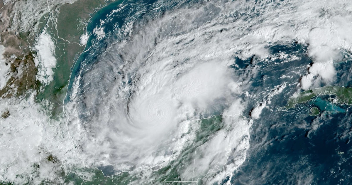
Hurricane Milton, now a powerful Category 5 storm with winds reaching 175 mph, has undergone a remarkable and rapid intensification, one of the fastest ever recorded. This type of rapid strengthening was nearly unthinkable a century ago. And shockingly, Milton is still gaining strength.
Major to catastrophic impacts from hurricane-force winds, storm surge, and torrential rain are expected Wednesday along Florida’s west coast, extending up to the Big Bend area. The Tampa Bay region, including Sarasota-Manatee, is in the path of the storm’s eye. With more than 48 hours to go, there is still some uncertainty about Milton’s exact landfall location, but residents should remain vigilant. A shift of 75 miles in either direction is possible, and such changes are typical at this stage.
While Milton is smaller in size compared to past hurricanes like Debby and Helene, it’s expected to grow as it approaches Florida’s west coast. As the Suncoast is already within the hurricane zone, significant impacts are inevitable, and all preparations must be finalized by Tuesday. Do not second-guess the advice of experts—following evacuation orders and safety recommendations could be life-saving.
It’s likely that Milton will go through an Eye Replacement Cycle (ERC), a process where the hurricane’s eye collapses and a new one forms. This often leads to a temporary weakening of winds but causes the storm to expand in size. This could happen late Tuesday or Wednesday, and when Milton makes landfall, it will likely be both large and dangerous, even if its peak intensity decreases slightly.
Storm surge poses one of the greatest threats to the region. Along the mid-Florida west coast, storm surge could reach 8 to 12 feet, with hurricane-driven waves adding to this danger. Those on barrier islands must evacuate immediately, and it’s critical for everyone to know their elevation and assess the risk of rising waters as evacuation routes could flood before Milton makes landfall.
In addition to storm surge, extreme winds are expected across the Suncoast, with some areas facing gusts exceeding 100 mph. With 6 to 12 inches of rain forecast on already saturated ground, flash flooding is also a significant concern, especially given the 50+ inches of rain that have already fallen in the region this summer.
Fortunately, there is still time to prepare. Remove any outdoor items that could become projectiles, secure vehicles, and move them to higher ground. Prepare your homes by clearing patios and securing loose debris. Heed evacuation orders and do not delay—many evacuation routes will flood long before the storm makes landfall.
Finally, know your elevation and do the math: if a 12-foot storm surge is expected and you live at sea level, the risk is too great to stay behind. Protect yourself and your loved ones by evacuating early. Our community is mobilizing—follow the advice of officials, and stay safe as Hurricane Milton approaches.
Social Cookies
Social Cookies are used to enable you to share pages and content you find interesting throughout the website through third-party social networking or other websites (including, potentially for advertising purposes related to social networking).